Tracking Environmental Changes from Space using Satellite-Based Observation
Intro
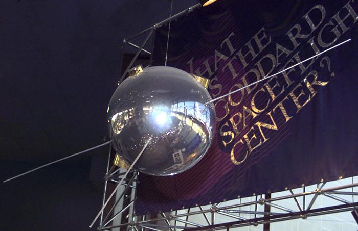
Satellites have been one of the most significant discoveries in recent human history. Less than one hundred years ago, with the official launch of the artificial satellite Sputnik 1 by the Soviet Union, this significant milestone in human history shaped the beginning of the Space Age. However, the age of satellites was not only for the space race, but also for Earth Observation, giving humanity a different view of their home planet.
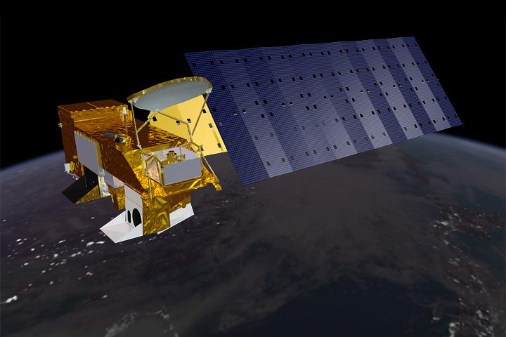
Satellite-based Earth observation has become one of the most powerful tools for monitoring our planet. Just two years later, in 1959, the Vanguard 2 launched, the first satellite explicitly designed for Earth observation. In the following year, TIROS-1 became the first successful weather satellite, paving the way for humans on Earth to see weather developments long before they occurred across the world and in their backyard, an aspect of humanity unheard of prior to this time period.
What We Can See from Space
By using satellites equipped with cameras, sensors, and radar systems, scientists can collect real-time data on Earth’s surface, atmosphere, and oceans. This technology allows for continuous observation of environmental changes across large and often remote areas. Furthermore, these satellites prove the alarming theory of rapid environmental change from space, painting a grim picture for the future of the planet.
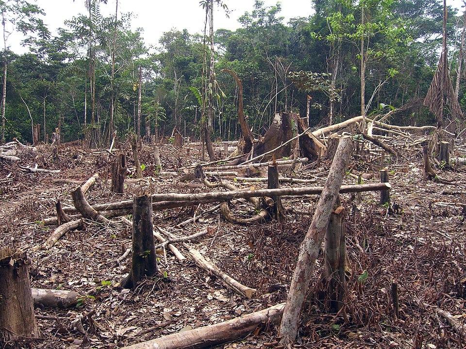
From detecting deforestation in the Amazon to measuring sea level rise and tracking wildfires, to tracking the melting of ice caps and volcano eruptions, satellite data helps researchers understand how human activities and natural processes are affecting the planet. These observations are critical for predicting natural disasters, managing natural resources, and studying the impacts of climate change.
Programs like NASA’s Earth Observing System and the European Space Agency’s Copernicus initiative provide open-access satellite data to scientists and decision-makers worldwide. As technology advances, Earth observation from space will continue to play a vital role in protecting our environment and planning for a sustainable future.
Satellites have also become central in responding to extreme weather events and environmental disasters. For example, during Hurricane Katrina in 2005, NASA's Terra and Aqua satellites tracked the storm’s intensity and path, providing early warnings that helped emergency response teams prepare. Today, the Sentinel-1 satellite of the ESA delivers radar imagery that can detect flooding even through cloud cover, improving disaster relief efforts in flood-prone regions. Additionally, satellites such as GRACE (Gravity Recovery and Climate Experiment) have measured groundwater depletion in major agricultural regions like California’s Central Valley, where over 16 cubic kilometers of groundwater were lost during the 2012–2016 drought. These types of measurements help governments prepare for water shortages and prevent future agricultural collapse.
Emissions, Cities, and Long-Term Trends
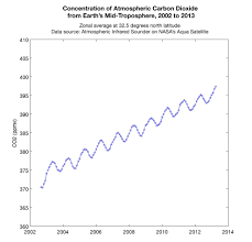
Beyond disaster response, Earth observation from space plays a key role in monitoring greenhouse gas emissions and urban expansion. The NASA OCO-2 satellite, launched in 2014, can precisely measure carbon dioxide levels in Earth’s atmosphere, allowing scientists to pinpoint sources of pollution and track trends over time. Meanwhile, satellites like Landsat have been used for decades to map urban sprawl in cities such as Beijing, where land cover change data revealed a doubling of urban area between 1990 and 2010. This information is crucial for sustainable urban planning and for enforcing environmental regulations. Without satellite-based monitoring, many of these changes would go unnoticed until they reached a crisis point.
Conclusion
From the moment satellites first began observing Earth, they have fundamentally changed how we understand and protect our planet. What was once invisible, rising seas, disappearing forests, and shrinking ice sheets can now be seen clearly from above. Satellite-based Earth observation not only helps us track the consequences of our actions but also gives us the tools to make informed decisions for the future. In a world where climate change and environmental degradation threaten ecosystems and communities alike, satellites offer hope through knowledge, connection, and global awareness. As we move deeper into the 21st century, the continued expansion and use of this technology may very well determine how well we protect the only home humanity has.

Leave Feedback!