Mapping Microclimates in Urban Areas with AI
As cities grow larger and denser, the way we experience heat, wind, shade, and air quality can vary dramatically from block to block. This variation, also called microclimate, explains why one street may feel hot and sticky while around the corner it feels breezy and cool. Together, they can affect our comfort, our health, and even our energy bills. They also play a huge role in how cities deal with climate change. In recent years, artificial intelligence has become a powerful tool for mapping and predicting these microclimates. With the usage of AI, we can have a better understanding of this ongoing issue and create better solutions.
How AI Helps Us Understand Microclimates
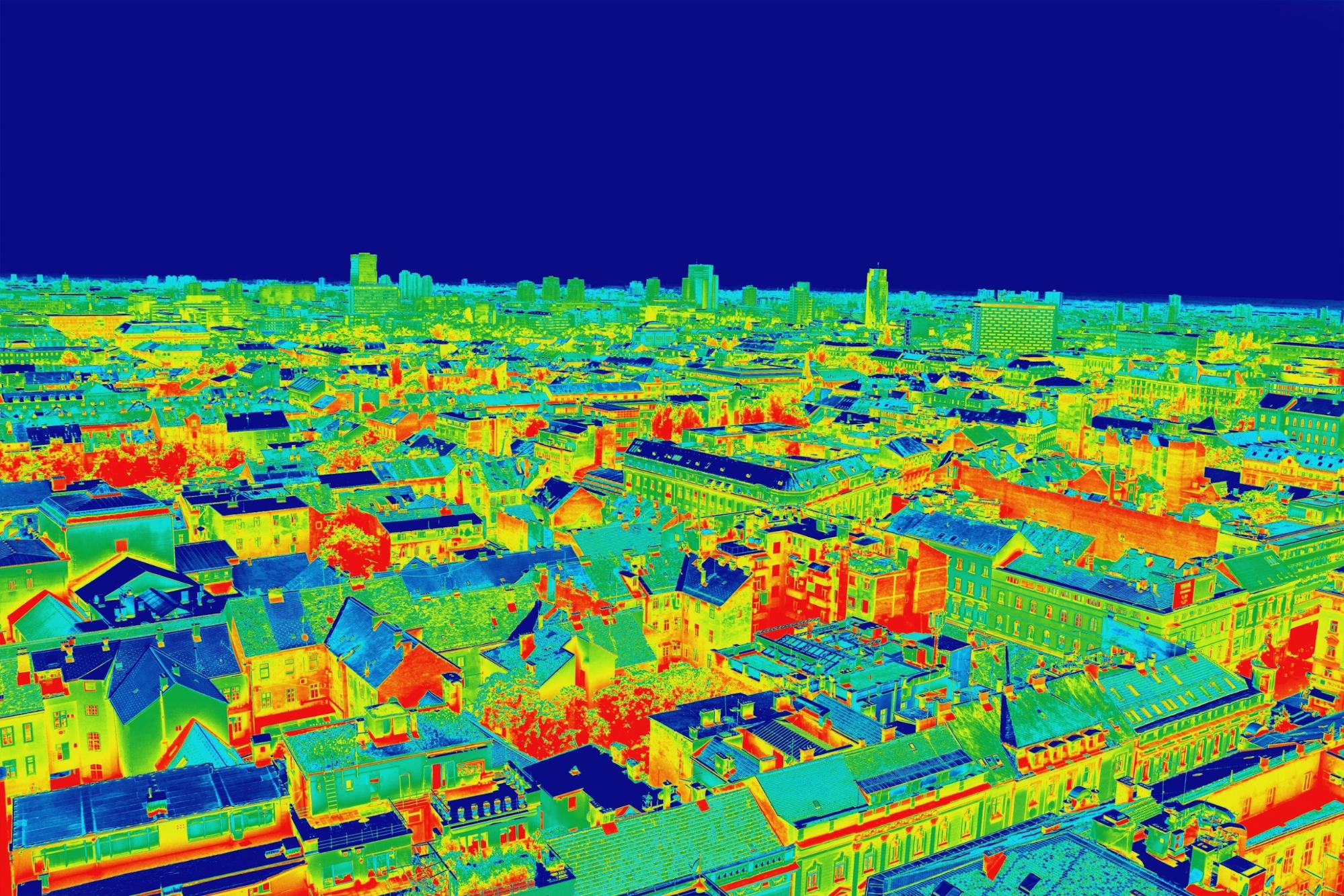
One of the biggest reasons why AI is helpful for mapping microclimates is that it is excellent at finding patterns in large amounts of data. For example, AI can combine satellite images, temperature readings, and even social media posts about weather to create detailed maps of how conditions vary across neighborhoods. While initiatives by governments or private organization may begin the use of AI to map out microclimates, it is the contribution of everyday people that makes this goal possible. Anyone with a smartphone can record temperature, air quality, or even how much shade is on their street at certain times of the day. By sharing this information through apps or community science projects, residents can become part of a giant city wide network that feeds data into AI models.
What Regular People Can Do with This Knowledge
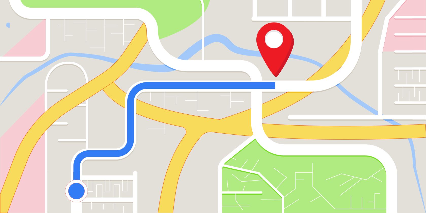
However, data collection isn’t the end of how we as regular people can have an impact on microclimates. One exciting part of mapping microclimates is how those results can be useful in our everyday lives. Imagine a neighborhood map that shows the coolest routs to walk on during a hot day or the best places to sit outside without breathing in heavy pollution. AI power microclimate maps can provide exactly that. For families, this could mean planning safer outdoor playtime during heat waves. For commuters, it could guide choices about biking versus taking public transit. And for community groups, it provides evidence to push for more trees, shaded bus stops, or green roofs in overheated parts of towns.
Real-World Example: Singapore’s AI City Planning
In many cities, such as Singapore’s, AI is already being used for this purpose. Specifically in Singapore, one of the world’ hottest and humid cities, researchers are using AI and data from the public to map microclimates at a street by street level. These maps show which areas trap heat the most and which can benefit from breezes or shade. With this knowledge, city planners design cooler neighborhoods by adding more trees, reshaping buildings to improve airflow, and installing reflective surfaces that bound heat away.
Why It Matters for Climate Change
While microclimates may seem like a small scale convenience issue, they do add up to major impacts on how cities handle climate change. The choices that we make not only benefits ourselves but also our environment. Hotter neighborhoods, for example, require more air conditioning, which increases energy use and carbon emissions. But when residents use AI-powered tools to identify these heat “hot spots”, city planners know exactly where to plant trees, add reflective surfaces, or improve cooling systems. By finding these overheated zones, cities can prioritize investments in green infrastructure lie urban forests, rooftop gardens, and permeable pavements. Over time, these improvements not only make neighborhoods more comfortable but also strengthen a city’s resilience against rising global temperatures and extreme weather events.

Conclusion
Mapping microclimates with AI might sound like high-level science and engineering, but in reality, it's an effort that combines a partnership between the technology and people. By collecting simple data, making local observations, and supporting climate friendly changes in communities, regular people play an important role in shaping how cities respond to climate change. What once required experts and expensive tools is now accessible to anyone with a phone, curiosity, and willingness to help out. Together, we can use AI not just to understand our neighborhoods better for our own sake, but to make them healthier, cooler, and more resilient against climate change.
Resources:
https://up2030-he.eu/2025/01/31/unveiling-urban-heat-islands-with-ai-a-path-to-cooler-cities/
https://cde.nus.edu.sg/nuscities/mapping-the-urban-heat-island
https://www.weforum.org/stories/2022/08/ways-to-cool-cities-and-avoid-urban-heat-islands/
https://www.c40knowledgehub.org/s/article/Strategies-for-cooling-Singapore?language=en_US
https://cityperspectives.smu.edu.sg/article/cooling-singapore-20-step-towards-becoming-cli
mate-resilient-and-regenerative-city
https://sec.ethz.ch/research/cs.html

Leave Feedback!